NOTE: Since most of the snowpack melted away in March, I’ve taken a breather from the site to attend to life: family, vacation, and completing my forecasting certification from Penn State. Posts may be more intermittent in the near term, but will likely pick up again later in the spring as my focus shifts from snow to summer mountain weather.
Backcountry obs.:
Lo and behold, despite a few sharks emerging from the depleted base, backcountry season holds on in the Mt. Rose area, with plenty of help from the recent multi-foot storm from 4/11-4/13. Touring from 8650′ to 9950′ at dawn on 4/15, revealed a transitional spring snowpack with everything from crust to powder. Below 9300′, differing varieties of sun crusts from supportable, soon-to-be corn, to breakable but nearly-unturnable death crust, covered all aspects. Higher up, winter snow and fluffy powder greeted this curious skier dropping into a north facing bowl at sunrise. Smiles quickly followed. However, once at lower elevations, navigating breakable crust made returning to the car without injury a more tenuous pursuit.
Worth noting is that despite the recent cold temps and cloud cover, the high April sun quickly transitions new snow from cold fluff, into baked mashed potatoes, to melt-freeze crusts on all but the most northerly aspects within a day or so. As long as there are refreezes, solar aspects transition to corn within a few days. As more snow falls in the next few weeks, expect conditions to change quickly. Timing will remain crucial to finding desired conditions.
Weather and forecast thoughts:
Things are moving again. The “stuck” pattern of persistent high pressure in the west and a trough in the east, so common this past winter, has been replaced by a transient and progressive parade of storms impacting the Sierra. For the latter half of April, ensembles agree on a mix of deep wandering low pressure systems and transient high pressure bringing fickle spring weather: periods of snow, rain, and wind interspersed with cool and sunny days. Even though the tide of the snowpack is in its inevitable retreat, occasional systems will likely add periodic refreshes over the High Sierra, slowing the outgoing tide.
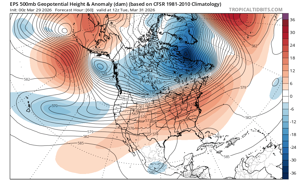
The 500mb anomaly analysis today through late next work week (4/16-4/23) helps illustrate the progressive pattern.
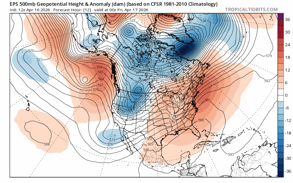
Today’s (4/16) cool, breezy weather associated with a departing trough in the Great Basin, gives way to a ridge of high pressure Fri – Sun (4/17-4/19) bringing mostly clear skies, moderating temperatures, and light winds for the first half of the coming weekend.
Expect highs in the backcountry above 8000′ to climb into the low 40s on Fri and mid 40s on Sat (4/17-4/18) under sunny skies with generally light winds. Breezes out of the N and NE on Fri will become variable Sat before transitioning back to the S and SW on Sun (4/19) ahead of the next weather system.
Lows on Fri and Sat nights will drop well below freezing, with some inversions developing both nights, keeping depressions and valleys a few degrees cooler than midslope areas. The combination of ample sun, light winds, above freezing days and cold nights will provide a great window for excellent spring corn skiing.
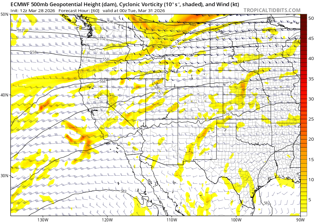
Sun (4/19) increasing SW winds and clouds will signal the arrival of the next storm system which will linger across the west for most of the coming week. Models suggest a fairly deep cutoff low pressure system dropping in from the Gulf of Alaska and meandering about off the CA coast before coming ashore midweek.
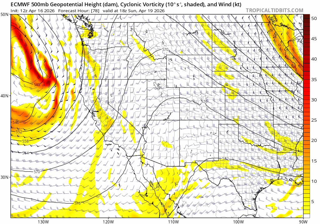
Lifting dynamics with this cutoff low look substantial. Coupled the seasonal instability common in spring, this system could also instigate afternoon convection and thunder along the Sierra.
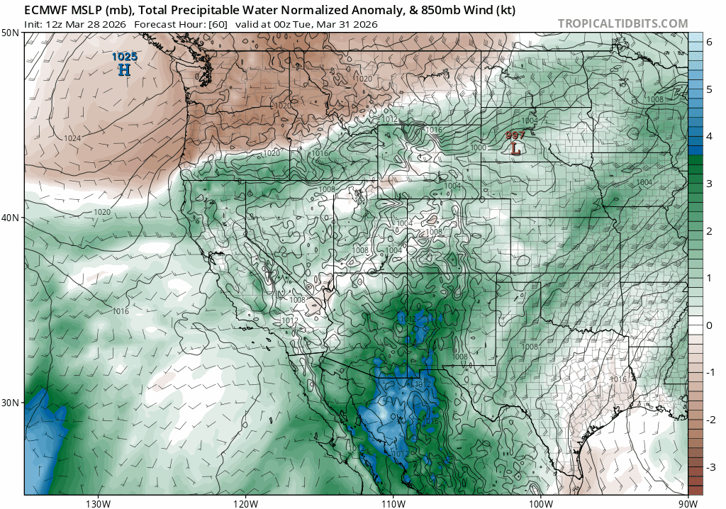
Models also suggest the system will phase with Pacific moisture, creating good chances for rain and snow in the backcountry. Below is the ECMWF forecast total precipitable water (PWAT) anomaly analysis for the same period. (PWAT anomaly shows how much more water than climatologically normal will be in the entire atmospheric column, able to be rained or snowed out.)
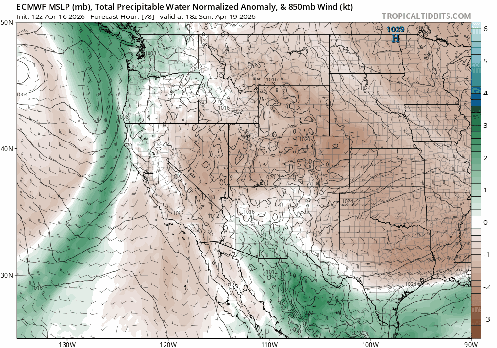
Because both the dynamics and moisture look to phase, expect unsettled weather with accumulating rain and snow across the backcountry.
Snow levels will likely fluctuate with the system dropping to near lake level at night starting Mon night (4/20), then rising again each afternoon with the heat of the day.
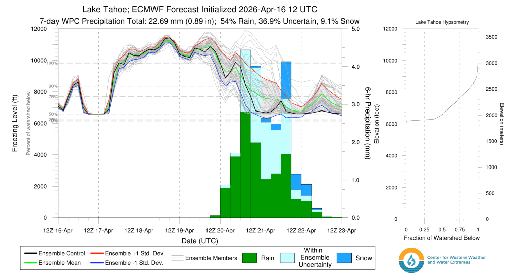
Because the low is dropping in from the cool Gulf of Alaska, it will bring colder air and lower snow levels to the Sierra. However, should it stall out over the warmer than average waters off the CA coast, snow levels would edge higher as the warmth of the ocean moderates air aloft.
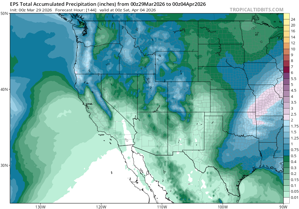
This far out, there is some model disagreement, along with the lower than normal skill models tend to have in April. Expect changes to the forecast as the week draws closer. A big dump looks unlikely, but unsettled days of rain and snow showers–and even some thunderstorms–look possible.
Until then, a brief window of cool sunny days and cold nights will bring great corn conditions across the higher terrain. Deep in the mountains, backcountry season hangs on.